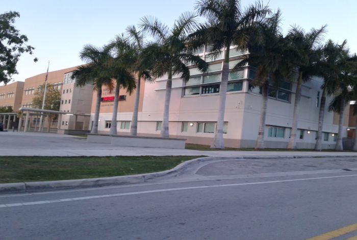
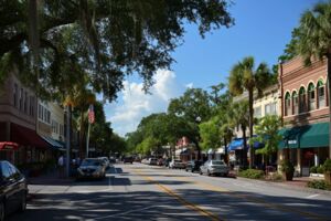
Homestead Base, Miami-Dade County, Florida
Homestead Base, Miami-Dade County, Florida


Homestead Base is a city in Miami-Dade County, Florida. As of the 2010 census, the city population was 964. The city has a total area of 4.35 square miles according to the United States Census Bureau. The density of the population was about 221 people per square mile. The median age was 22.3 years (The median age in the state of Florida was 41.8). There were 100 males for every 191 females.
Local Time in
Homestead Base
- :
- :

John Doe
”One Property” Website
Driftwood Terrace Boca Raton, FL 33431
Email: service.myre@gmail.com
Phone: (555) 555-55-55
I take the time to listen carefully to understand my client’s needs, wants and concerns. I will be ready to take quick action when required and spend more time with those who aren’t quite sure which direction to take. My genuine concern for my client’s best interests and happiness ensures the job is done!
Description of the Population
Population (Year: 2010) | 964 residents |
Population Change | +116.1% since 2000 year |
Residents Median Age | 22.3 years (State: 41.8) |
Below the Poverty Line | 98.6% (Year: 2015) |
Population Males | 633 residents |
Population Females | 331 residents |
Foreign Born Residents | 20.9% Latin America |
Unemployment (Year: 2015) | 6.3% (State: 5.4%) |
Elections Results Data
English Language Proficiency by Native Speakers
Homestead Base Marital Status Data (Over 15 Years Old)
Homestead Base Residents Living Below the Poverty Line (According to 2015)
Year of Entry of Foreign-born Homestead Base Residents
Countries for Foreign-Born Residents
Financial Information
Median Gross Rent (Year: 2015) | $177 |
Cost of Living Index (Date: February 2016) | 97 (USA: 100) |
Median Household Income (Year: 2015) | $11,709 (State: $49,426) |
Changes in Household Income | -$32,041 since 2000 year |
Median Per Capita Income (Year: 2015) | $2,286 |
Changes in Per Capita Income | -$3,895 since 2000 year |
Education Data (by Residents, Schools, Colleges)
Education attainment (25+ years residents)
Males 25 Years and Older
Females 25 Years and Older
Nearest Colleges & Universities- University of Miami Distance: About 18 MilesCoral Gables, FLFull-Time Enrollment: 13,674
- Florida Career College-Miami Distance: About 19 MilesMiami, FLFull-Time Enrollment: 10,133
- Florida International University Distance: About 19 MilesMiami, FLFull-Time Enrollment: 41,234
- Miami Dade College Distance: About 24 MilesMiami, FLFull-Time Enrollment: 53,787
- AI Miami International University of Art and Design Distance: About 25 MilesMiami, FLFull-Time Enrollment: 3,578
- Florida National University-Main Campus Distance: About 27 MilesHialeah, FLFull-Time Enrollment: 4,106
- Barry University Distance: About 30 MilesMiami, FLFull-Time Enrollment: 7,181
Distance: About 18 Miles
Coral Gables, FL
Full-Time Enrollment: 13,674
Distance: About 19 Miles
Miami, FL
Full-Time Enrollment: 10,133
Distance: About 19 Miles
Miami, FL
Full-Time Enrollment: 41,234
Distance: About 24 Miles
Miami, FL
Full-Time Enrollment: 53,787
Distance: About 25 Miles
Miami, FL
Full-Time Enrollment: 3,578
Distance: About 27 Miles
Hialeah, FL
Full-Time Enrollment: 4,106
Distance: About 30 Miles
Miami, FL
Full-Time Enrollment: 7,181
Labor Market Description
Unemployment Rate
Male: Employment in Industries (Services)
Female: Employment in Industries (Services)
Male: Most Common Occupations
Female: Most Common Occupations
Homestead Base Infrastructure
Grocery Stores in the City | 597 stores | ||||||||||||||
Grocery Stores per 10,000 Citizens | 2.51 (State: 2.04) | ||||||||||||||
Supercenters in the City | 15 centers | ||||||||||||||
Supercenters per 10,000 Citizens | 0.06 (State: 0.11) Non-gas Station Convenience Stores 285 stores Convenience Stores per 10,000 (no Gas) 1.20 (State: 1.28) Convenience Stores at Gas Stations 473 stores Convenience Stores per 10,000 (with Gas) 1.98 (State: 3.04) Number of Restaurants in the City 1,610 restaurant Restaurants per 10,000 Citizens 6.76 (State: 7.45) Number of Houses in the City 7 |
Hospitals in Homestead Base- FMC – NARANJA Dialysis FacilityDistance: About 3 MilesHOMESTEAD, FL
- HOUSE CALL HOME HEALTH AGENCY CORP Home Health CenterDistance: About 5 MilesHOMESTEAD, FL
- SIGNATURE HEALTHCARE OF BROOKWOOD GARDENS Nursing HomeDistance: About 5 MilesHOMESTEAD, FL
- ALTUS HOME HEALTH SERVICES LLC Home Health CenterDistance: About 6 MilesHOMESTEAD, FL
- HOMESTEAD ARTIFICIAL KIDNEY CENTER Dialysis FacilityDistance: About 6 MilesHOMESTEAD, FL
- TODAY’S HOME HEALTH SERVICES INC Home Health CenterDistance: About 6 MilesHOMESTEAD, FL
- HORIZON HOME HEALTH CARE INC Home Health CenterDistance: About 6 MilesHOMESTEAD, FL
Dialysis Facility
Distance: About 3 Miles
HOMESTEAD, FL
Home Health Center
Distance: About 5 Miles
HOMESTEAD, FL
Nursing Home
Distance: About 5 Miles
HOMESTEAD, FL
Home Health Center
Distance: About 6 Miles
HOMESTEAD, FL
Dialysis Facility
Distance: About 6 Miles
HOMESTEAD, FL
Home Health Center
Distance: About 6 Miles
HOMESTEAD, FL
Home Health Center
Distance: About 6 Miles
HOMESTEAD, FL
Amtrak Stations in Homestead Base- 6 miles: HOMESTEAD (5 N.E. 3RD RD.) Services: Bus Station, Enclosed Waiting Area, Public Restrooms, Public Pay Phones, Vending Machines
Services: Bus Station, Enclosed Waiting Area, Public Restrooms, Public Pay Phones, Vending Machines
Nuclear Plants near the City- Turkey Point 3 and 4 (Location: Florida City, FL., Distance: 7 miles)
Average Travel Time to Work
Means of Transportation for Getting to Work
Other Information
Homestead Base by Race (According to 2010)
Median Unit Value (According to 2015)
Natural Disasters in Homestead Base
Air Quality Information
Common Weather Information
Tornadoes Average Activity | 51% (Smaller then US) |
Earthquakes Average Activity | 99% (Smaller then US) |
Number of Natural Disasters | 8 pc. (State: 13 pc.) |
Number of Major Disasters | 5 pc. |
Number of Emergencies Disasters | 3 pc. |
Google Map of Homestead Base
ZIP Codes for Homestead Base: 33032, 33039
Nearby Cities
Leisure City
Distance: 2.22 miles
Direction: 270° W
Population: 22,655 residents
Naranja
Distance: 2.42 miles
Direction: 311° NW
Population: 8,303 residents

Princeton
Distance: 3.15 miles
Direction: 342° N
Population: 22,038 residents

Goulds
Distance: 4.72 miles
Direction: 8° N
Population: 10,103 residents
Homestead
Distance: 5.54 miles
Direction: 250° W
Population: 65,524 residents
Florida City
Distance: 6.25 miles
Direction: 238° SW
Population: 12,062 residents

Cutler Bay
Distance: 6.61 miles
Direction: 26° NE
Population: 26,918 residents
South Miami Heights
Distance: 7.13 miles
Direction: 6° N
Population: 35,696 residents

West Perrine
Distance: 7.9 miles
Direction: 14° N
Population: 9,460 residents